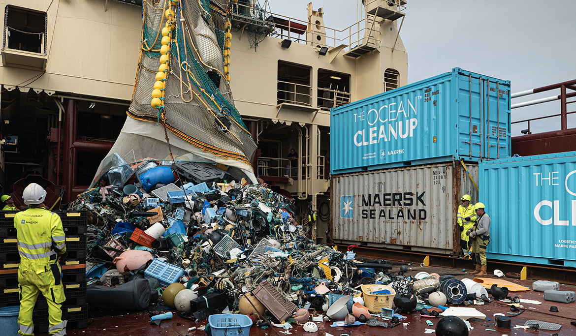
Thu Nov 18 2021

Semi-supervised forest monitoring from space

Earth observation has become much more accessible in recent years, with satellite imagery being freely available at mid resolution (Landsat, Sentinel), or commercially opened up to what before was only available to governments research or defense agencies (planet, airbus). This also means that many novel machine learning approaches can be applied to gather insights on a planetary scale, at increased resolution and time scales, by many new startups, such as Overstory.

In this talk Roelof Pieters, CTO and co-founder of Overstory, will take you on a whirlwind tour of the wonderful world that is remote sensing, especially how satellite imagery can help keep forests healthy or protect against forest fires, deforestation, and power outages. This is a big deal, as over 1.6 billion people depend on forests for their livelihoods and under pressure of climate change this topic has become even more important safeguarding the climate by sequestering carbon.

The second part of the talk will dive into some of the more recent ML techniques on into how to make sense of such large quantities of data (imagery datasets that grow by petabytes each day), limited and noisy labels (that our world is constantly changing becomes extremely visible from space) and topics such as semi supervised learning, multi task/taxonomy learning, vision transformers, and “human-in-the-loop” active learning applied to satellite imagery at scale.

About the speakers

Roelof Pieters

CTO and co-founder

Roelof Pieters is CTO and co-founder of Overstory, a startup providing forest intelligence through state of the art machine learning, satellite imagery, and computing power. He has a background in Computer Science, anthropology, and renewable energy. Naturally he loves trees and nature!